
Documenting the sights and moments as well as tips for fellow EV travelers to inspire your own adventures through the Southwest in an environmentally conscious way. May you have safe and happy travels!
When Grant proposed that I quit my corporate job a month early to join him on a road trip through the American Southwest, it didn’t take a whole lot of convincing. I wanted to return to that place where the sole responsibility each day would be to wake up before the crack of dawn and go out hiking. I wanted large strides and hearty breaths to help me up a mountain and to take in the vast panoramic views around me, all before breakfast. I had not yet been to this region of the world and very quickly learned that to visit the Southwest is to become a geological witness to our planet’s timeline. These sights helped me to better understand the depth of geological time as I saw it before me. Taking the shape of cliffs, canyons and valleys that represented the passing of 4.6 billion years. To me, this was absolutely mind blowing and continued to amaze me with each and every stop over, climb, and hike. Over the unfathomable amount of geological time, in which humanity is but a pencil-thin streak along the rocks, the wind and water blew, compressed, carved, and formed these awe-inspiring shapes, structures and colors.
While this post is intended to encourage people to see our National Parks and to get outdoors, it feels necessary to address another, more somber aspect of my experience. As we travelled across Arizona and Utah, I constantly felt reminded of the tragic and unjust the treatment of Native Americans by this country. This land is so majestic, awe inspiring, and grandiose. Interwoven with populations that respected it, and it was seized by those who developed, industrialized, and commercialized it. I would feel a twinge of pain taking in majestic beauty of the land that was also once rich in Native history and culture, now desecrated, erased, and reduced to roadside plaques. It was painful, but an important thing to try to come to terms with nonetheless. I would like to share with you some of our experiences navigating these notions through landscape in this post, and we begin the journey in Death Valley…
Zabriskie Point, Death Valley
Day 1- las Vegas, nv to death valley, ca
While Grant drove cross-country from Miami, I was stuck on the East coast putting in my two weeks notice at my corporate job. Financial constraints and work obligations kept me in Miami, and so I agreed to begin my portion of the trip 10 days after Grant departed by flying into Las Vegas and meeting him there. I arrived in the afternoon at around 2pm. We took route 15 to Shoshone and arrived Death Valley National Park by night. We spent the night at Oasis Inn as it was one of the only places in the park where a charging station was available. The location was phenomenal, situated in the park, 2 minutes driving to Zabriskie Point, where we planned to head to for sunrise.
Zabriskie Point offers stunning views of the Badlands and Manly Beacon at sunrise
Day 2- death valley, ca
We woke up just before first light to catch the sun rising from Zabriskie Point. There is the lookout point as well as a short but steep and narrow trail. We took the trail along the ridge of the mountains as the sun was coming up, offering us stunning views of the badlands as we hiked along.
After getting more than 8k steps in before a well deserved breakfast, we packed our bags and hopped in the Tesla to hit up a few spots in Death Valley and make our way through and out of the park.
We took Artists Drive and pulled over to take an easy 0.4 mile out & back hike through Artists Palette, which cuts into the Black Mountains. The landform contains a variety of minerals that have oxidized and produced amazing and uncanny pigmentation, producing a unique palette of colors fit for an artist. We spent about an hour exploring and picking up beautiful purple, yellow, green, and red rocks of our own.
We ended the loop of Artists Drive and next we headed over to Badwater Basin a salt flat that is located at the lowest elevation in the United States, at 200 feet below sea level. See photo of my avocado for a tasty snack salted by the flats themselves.


The drive out of the park is beautiful and scenic, and took about one hour to arrive back in Shoshone. We stopped at a diner, had some lunch, and headed to an FF (first come first serve) campground that was, unfortunately, full! By this point it was dark and not suitable to go searching for another site, so we stayed in a hotel with a charger in San Bernadino.
Miles: 7.35
Song of the day: Feelin’ Alright, Joe Cocker.
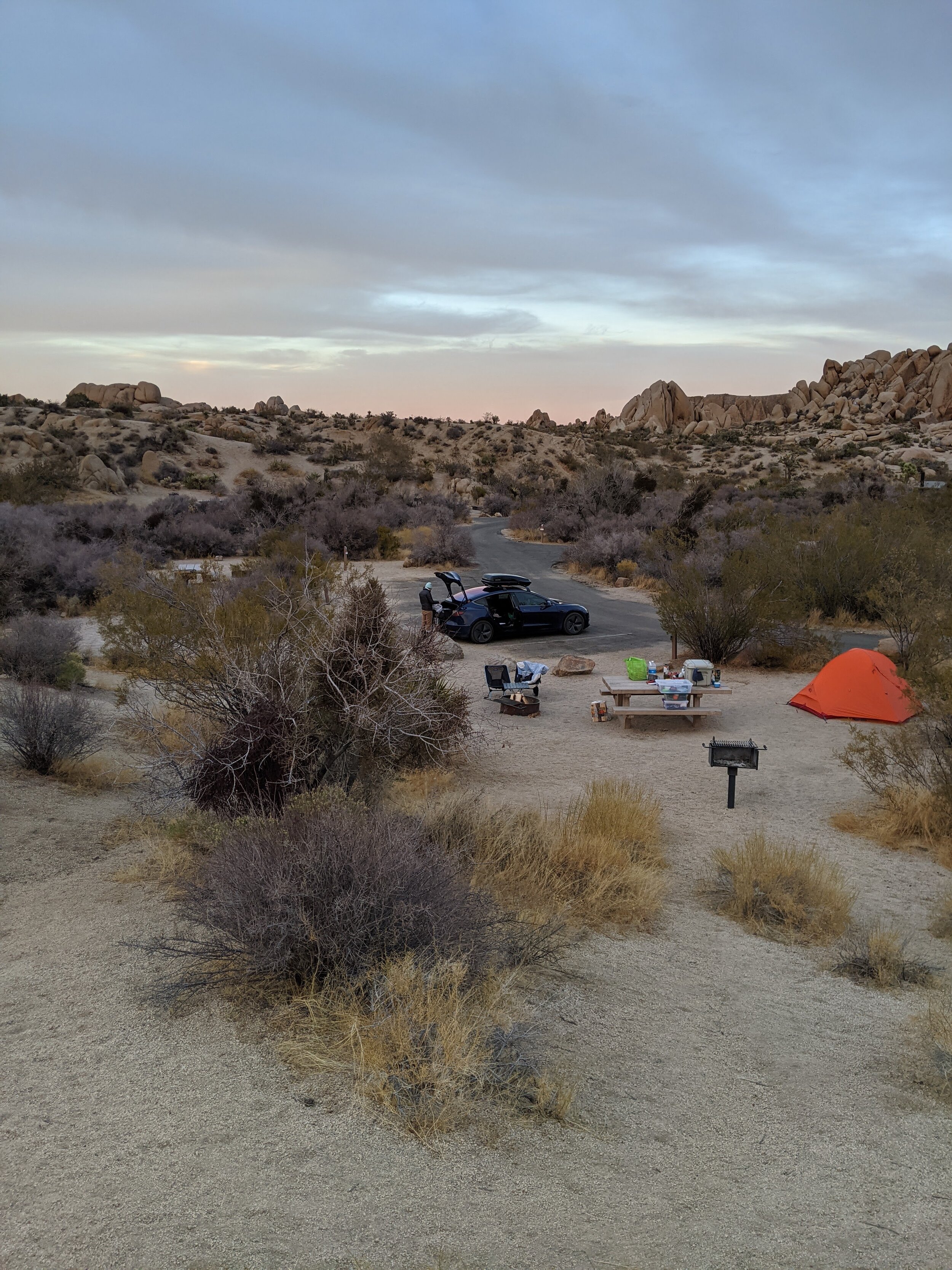
Jumbo Rocks at Joshua Tree
Day 3 - joshua tree, ca
We got an early start to drive from San Bernadino to arrive at Joshua Tree National Park by the early afternoon. I made a mental note to check out San Bernadino on another trip, the forests and lakes look sublime.
We entered through the West Entrance of the Park. We had 2 nights reserved in advance at Jumbo Rocks Camp Ground. We set up camp and then did a few trails. Split Rock Trail, Discovery Rock Trail, and Skull Rock Trail are all very close together and near to our site.

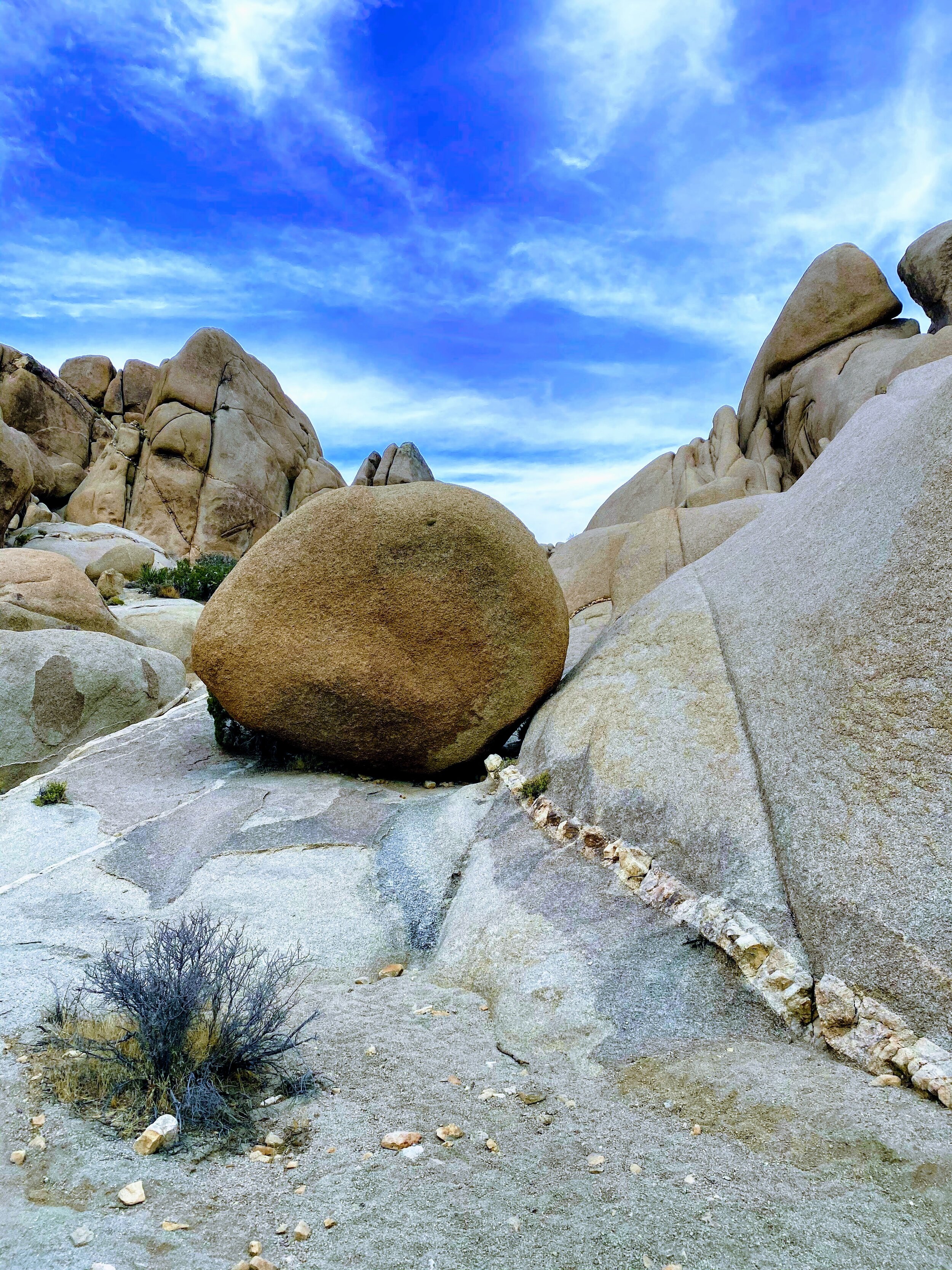


In all we spent a couple of hours doing these trails and then made our way over to Hall of Horrors to watch the sun set. The texture and shape of the rocks in the park is unlike anything I had ever experienced. The texture is very grippy and you can easily scramble up the massive boulders that appear loosely stacked atop one another but are fused together over millions of years. We did some scrambling up some massive boulders by Hall of Horrors to watch the sun set over the desert landscape peppered with Joshua trees.
Face Rock encountered on Discovery Rock Trail
Although my observations of such unique rock formations had begun in Death Valley, it was really starting to dawn on me how this area of the world is so geologically important, and provides us with a visual of our planet’s timeline. I began to feel as though I had taken a geological field trip that was bringing me back in time, and that these rocks tell a story of our history.
Miles: 6.84
Song of the Day: Something Holy, Alice Phoebe Lou
Day 4 - joshua tree, ca
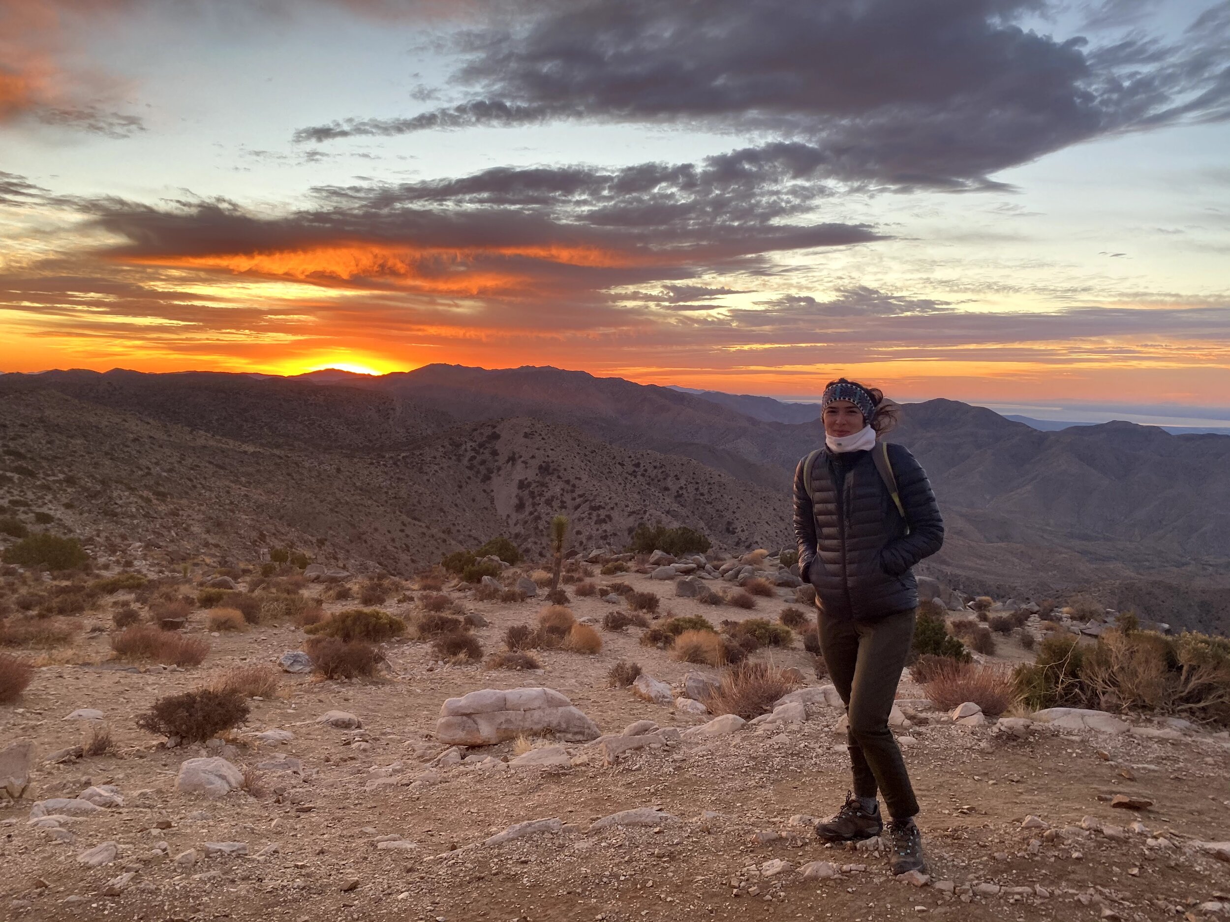
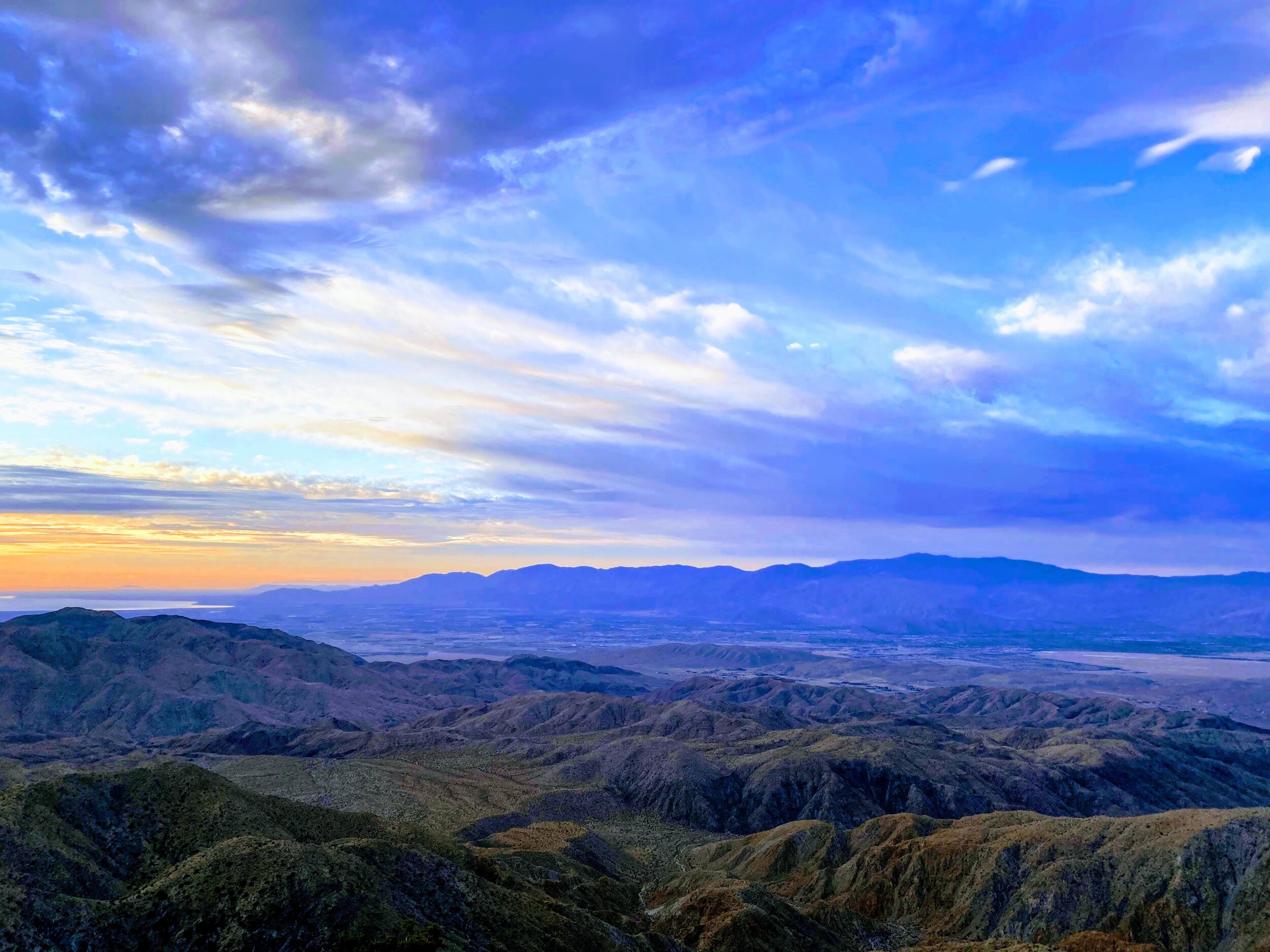
We woke up around 5:30AM to drive over to Keys Viewpoint for Sunrise. In the winter, we were lucky to have spectacular views of the Coachella Valley and Signal Mountain all the way in Mexico that is usually obscured by smog.


Because our specific campsite did not have a place to plug in, we charged at a casino outside of park entrance closest to the Oasis Visitors Center. We also picked up coffee and breakfast at Campbell Hill Bakery which we highly recommend, and got some sandwiches to go. We re-entered the park and stopped by Cholla (pronounced Choya) Garden. Cholla’s are prickly cacti that grow in abundance and in different varieties in the southwest. The cholla’s pictured here are called teddybear cholla, don’t let the name deceive you!


Summits On Air guy setting up his antenna - he transmits his messages in Morse code and said the farthest distance he has connected to was all the way to New Zealand!
Next, we did a moderate 3 mile out & back hike to the top of Ryan Mountain. When we reached the top, we had our Campbell Hill Bakery sandwiches and and met a man at the top who was a participant in Summits On Air.
In the afternoon we went over to Barker Dam and Hidden Valley, both easy and scenic trails. We got back to our campsite by sundown, had dinner, and did some stargazing.
Miles: 8.5
Song of the Day: Crazy Dream, Tom Misch
Day 5 - joshua tree ca, to sedona, az
For sunrise, we awoke and scrambled up the boulders in our campsite located on the Jumbo Rocks Campground Loop. We packed up camp and hit up Campbell Hill Bakery one more time (it was just that good) for breakfast sandwiches, coffee, and lunch sandwiches for the road.
John Lemonade, “Imagine all the thirsty people”….
We Stopped for charge in Quartzite but didn’t really stick around, there wasn’t much to see in our opinion. We did stock up on some provisions at the Really Good Jerky Store which was super quirky and had an interesting selection (see buffalo wing soda picture). They also gave out free Jerky samples. Charged up, we hit the road and arrived in Sedona by evening, where we had 4 nights booked at the Desert Jewel Air BnB.
Miles: 3.91
Song of the Day: Thinking of a Place, War on Drugs
The quirkiest of breakfast nooks!
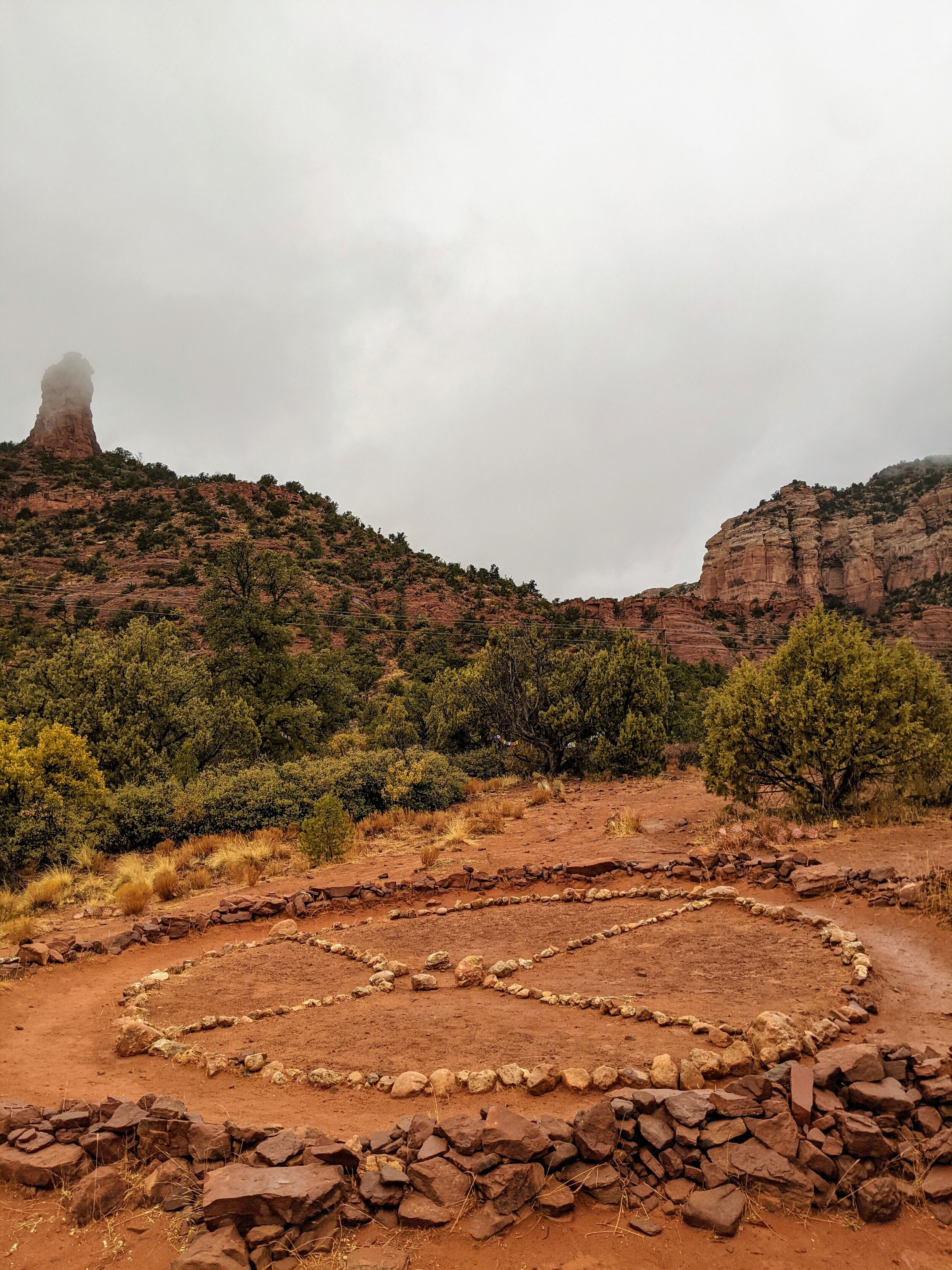
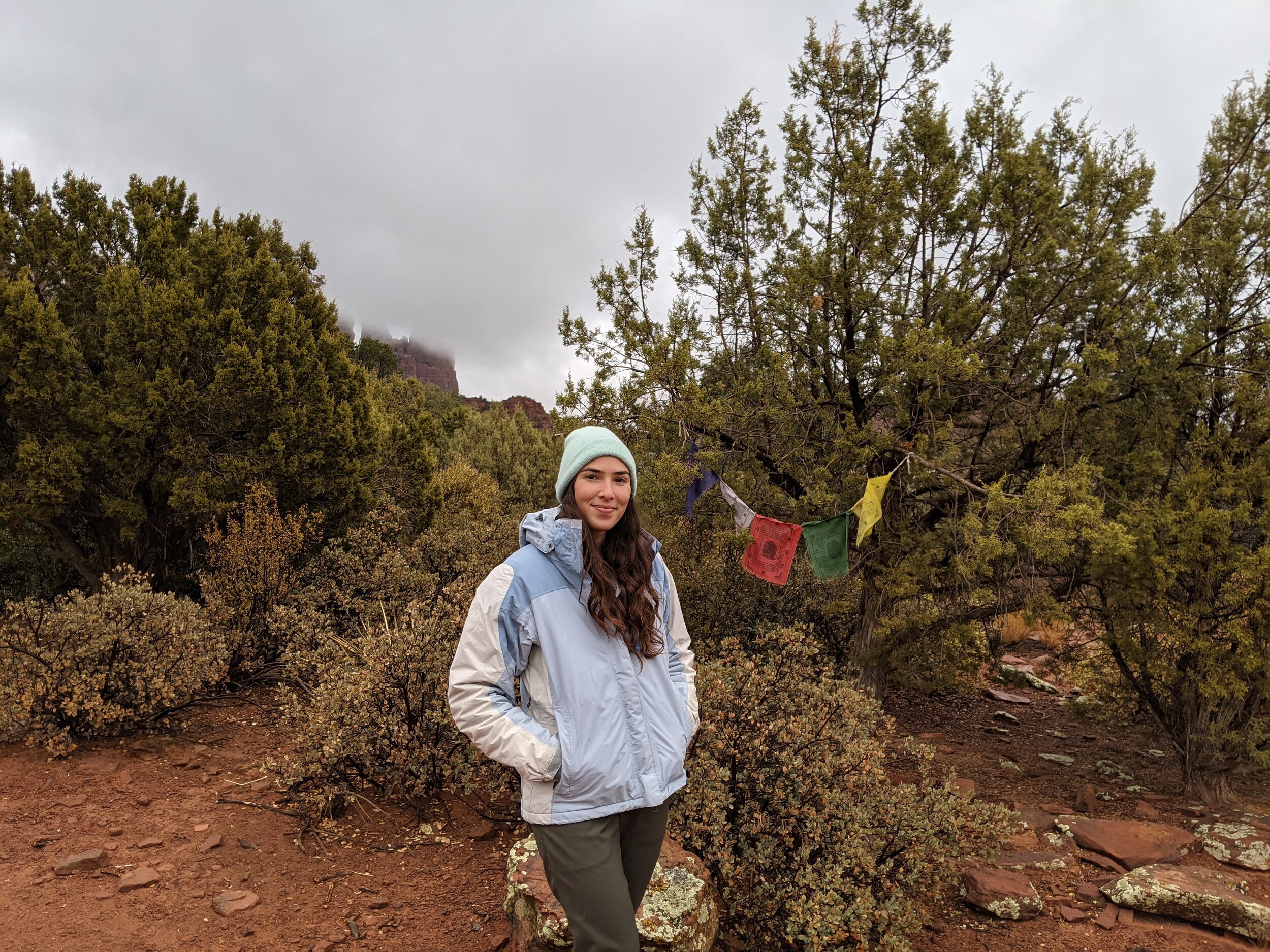
Day 6 -sedona, az
Our first day in Sedona was rainy, a blessing for the locals since they’re facing a drought, a bummer for us since the trails were slick and muddy. We decided to save our hikes for the next few days. We proceeded to fill our morning with a delicious home cooked breakfast in our quirky Air BnB, photo editing in the breakfast nook, and a more route planning.
Only the highest of vibrations at Chocolatree
In the afternoon we ate lunch at Chocolatree Organic Eatery, hands down one of my favorite organic restaurants out there. The food is such high vibrational quality, and the ambience so incredibly thoughtful and detail oriented. We felt just right to go and wander through the Amitabha Stupa and Peace Park, with Stupa and Medicine Wheels. We contemplated the land around us as we serenely walked three times around the stupa and gave thanks for our journey.
To avoid being out in the rain, we headed to the incredibly touristic Tlaquepaque Center had a couple of nice shops including the Chai Spot where we stopped for some chai, Turkish delights, and a game of mancala in the outdoor lounge area.
We ended the day by taking a scenic drive back through West Sedona and stopped at an overlook of Crescent Moon Picnic Site where you can see the sun setting behind Cathedral Rock in the distance.
Miles: 5.0
Song of the Day: Hara Hara Mahaadeva, Krishna Das


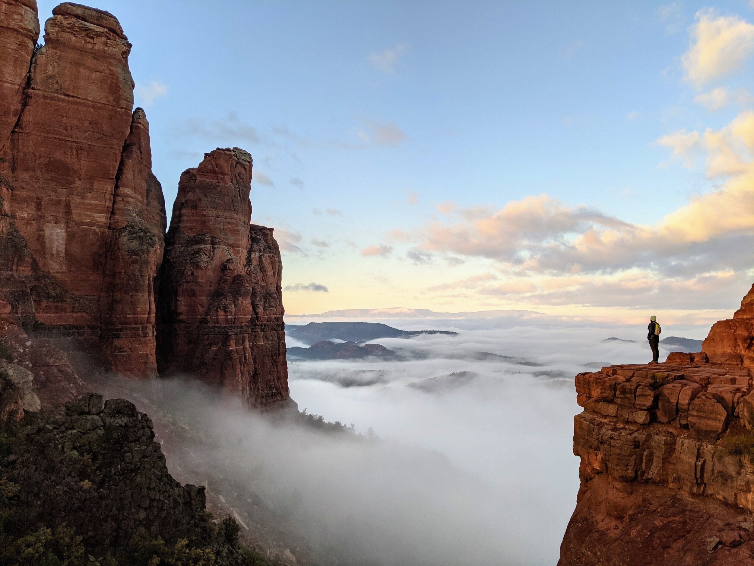
day 7 - sedona, az
Cathedral Rock, Sedona, AZ
We woke up before dawn for a hike up Cathedral Rock for sunrise. This is a very popular viewpoint and I highly recommend going as early as you can. The combination of setting out early plus hiking in the off season resulted in very few people there, albeit foggy from the rain the day before. We still had some nice moments with the sun peeping through the clouds and revealing some beautiful views of the forest depths below.


Jim Thompson Trail, Sedona, AZ
As per a local recommendation, we drove over to take the Jim Thompson Trail which features views of Steamboat Rock. The trail was much less populated, on the way out we had the whole trail to ourselves. We did a bit of off-trail exploring trying to climb up steamboat rock, but turned back at the point where the scrambling got a little too hairy.
Devil’s Kitchen, Sedona, AZ
We took the Cibola Pass Trail to get to Devil’s Kitchen and Seven Sacred Pools
In the vicinity of the Jim Thompson Trailhead, there are several other popular trailheads which we moved on to. We hiked through Cibola Pass to Devil’s Kitchen and the Seven Sacred Pools. We ate lunch out at the pools, which were not as spectacular as they must be in the Summer when they are full of water.
We turned back in the mid-afternoon and headed over to Chocolatree for warm tonics. I recommend the Big Heart tonic, it was just a cup of warm goodness.
At night we hopped in the hot tub at Desert Jewel Air BnB to relax and stargaze.
Miles: 12.8
Song of the Day: I Wish I Knew How It Would Feel to Be Free, Nina Simone
day 8 - sedona, az
Another populated trail with a highly photographed viewpoint is Devil’s Bridge. We woke up at sunrise to do this trail to avoid big crowds. There are a few trails you can take leading up to Devil’s Bridge, ranging from easy to hard based on distance. The trails were not very clearly marked, and we ended up on the easy trail which is a roadway that cars can pass through, ideally we would have taken a moderate, less populated trail up to the base of the mountain.
After Devil’s Bridge, we drove over to another trail area where we climbed up Bell Rock and found the Bell Rock Vortex. There are several marked vortices in Sedona, it’s one of the attractions of the area, where people go to experience an energetically powerful area. We were pretty stoked when we explored all around Bell Rock and happened upon the vortex on our own. We did Baby Bell Trail and Lama Trail, which were both easy loops and give you a nice view of Bell Rock.
Miles: 11.51
Song of the Day: Remember Me - Original Mix, Blue Boy


Day 9 - Sedona, to grand canyon national park, az
Our last sunrise in Sedona was spent watching the sunrise from the hot tub before hitting a trail very close to Desert Jewel Air BnB. We hiked the Crescent Moon Trail to Buddha Beach. There was a $10 entry fee for this park for vehicle entry.
We left Sedona in the late morning (after one last stop at Chocolatree of course!) and headed for the Grand Canyon National Park. As we drove about 2 hours North towards the Grand Canyon, the elevation gain was quite noticeable as we ascended from an elevation of 4000 feet to 8000 to reach Grand Canyon National Park. We arrived in time to check in at Yavapai Lodge inside the park, and to catch the sunset from Hopi Point.
Miles: 7.81
Song of the Day: Sorry You’re Sick, Ted Hawkins
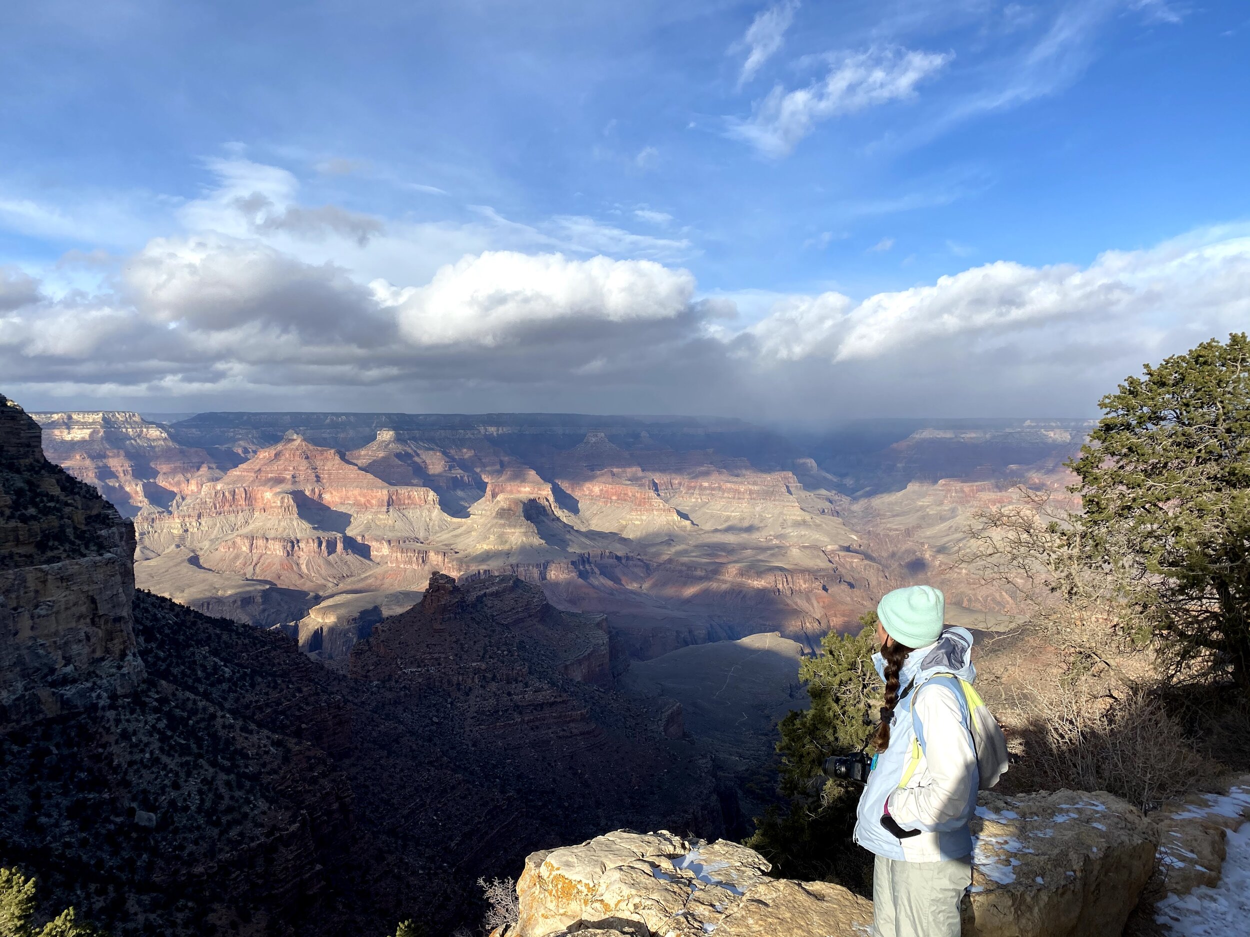
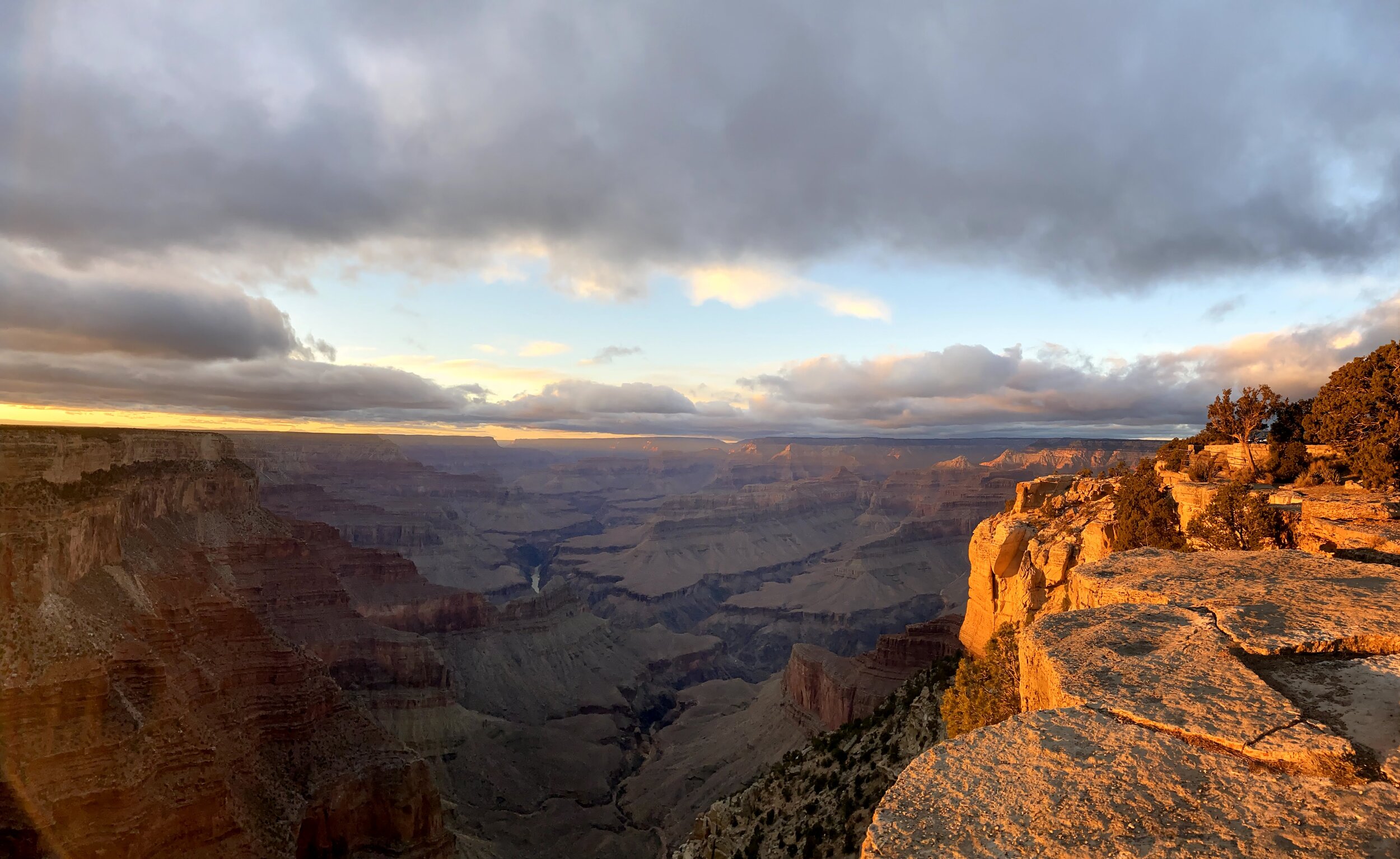
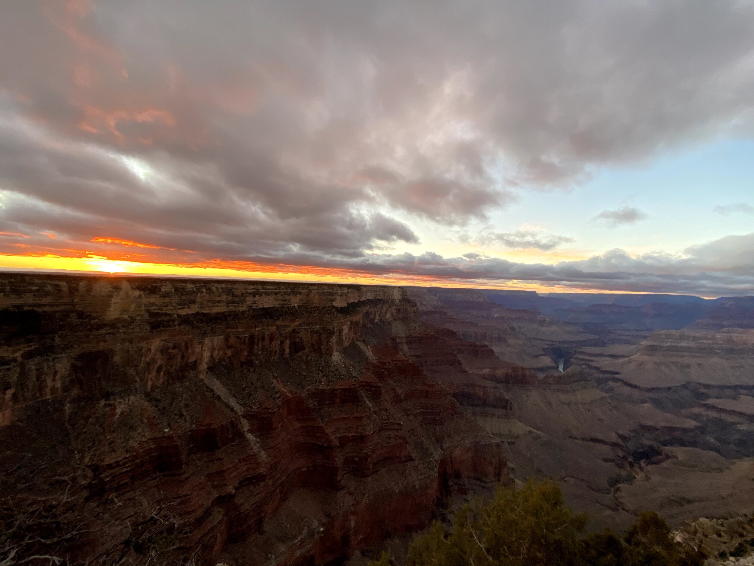
day 10- grand canyon national park, az
View from Bright Angel Trail, Grand Canyon National Park
What we enjoyed about visiting the parks in the off-season is that trails that are typically accessible by shuttle bus only are open for vehicles to pass through, which is convenient since we can do everything on our own time, and guilt free since we are zero emission in an EV. We did the majority of the Rim Trail in one day, other hikes such as South Kaibab Trail and Bright Angel trail were also options, each can be as long as you make them and can last up to a day or even longer if you do a rim to rim trail crossing.
The Geology Museum had a pretty spectacular view of the canyon from the rim, it is worth going inside to see the panorama.
We did a portion of the Bright Angel Trail we went as far down as we liked and then turned back up. Beyond the Bright Angel Trailhead is the the Maricopa Point lookout which provided a nice vista of the winding trail as well as the Indian Garden at the bottom of the trail.
In the late afternoon, we drove in the direction of Hermit’s Rest, and ended up at a viewpoint just before called the Abyss for sunset.
Miles: 8.5
Song of the Day: Cheer Up, My Brother, HNNY


day 11- grand canyon national park to page, az
The temperature at dawn at Yaki Point on this day was 13 degrees Fahrenheit, which felt like well below zero and brought me back to my days living through Montreal winters! It was worth the below freezing temperatures for a peaceful and spectacular sunrise over the rim.
We packed up and drove out of the Grand Canyon national park to our next stop, Page, AZ. We made some stops along the way, pit stop to charge and had lunch at The Toasted Owl in Flagstaff. We also stopped at the Navajo Bridge and caught the view of Horseshoe Bend just as the sun was just going down.
Horseshoe Bend, Page, AZ
We charged in Page, and spent the night with plans to do a hike at sunrise in Page before moving on.
Miles: 6.0
Song of the Day: Ponta de Areia, Wayne Shorter
day 12- page, az to kanab, ut
The Hanging Garden, Page, AZ
We went for a sunrise walk to Hanging Garden Trail, and easy out and back to a massive rock face with a large patch of ferns covering the surface of the vertical rock.
Before leaving Page, we stopped at the Glen Canyon Dam for a nice view of Lake Powell below. As we headed North to Utah, we noticed that there are several trails to be found between Page and Kanab, Utah, but many of them require all terrain vehicles to enter, which unfortunately the Tesla Model 3 is not equipped to handle and we did not want to take our chances by doing some off-roading in ice and rock.
Luckily one of the trails that I really wanted to take was accessible, which leads to the Toadstool Hoodos.

Toadstool Hoodoos , Kanab UT
The Toadstools were totally secluded. The lack of people and the red rocky hoodoos made it feel like we were setting foot on Mars. Hoodoos are rock formations that are made up of different types of rock, where the lower rock has eroded faster than the top layer, forming the shape of a toadstool. We stayed here for a couple of hours, exploring our own little Martian planet.


We stopped in Kanab, UT to charge at Best Friends Roadhouse and Mercantile which is a non-profit animal sanctuary that has a huge presence in this town. While we charged we had lunch at Kanab Creek Bakery and went to the supermarket to get provisions to the day’s final destination- Bryce Canyon National Park.
On our way to Zion, we made a pit stop at Coral Pink Sand Dunes State Park which was as fun as it was physically exhausting, which was very! You can rent sleds or sand boards and go boarding down the dunes. Super fun going down, a massive leg workout running back up! Running at full speed down the dunes makes the hike up worthwhile, and we felt totally carefree as we frolicked and ran down the dunes without consequence if we tumbled. The surrounding mountainous landscape was a beautiful contrast to the Sahara Desert-like dunes.
Miles: 8.81
Song of the Day: Man We Was Lonely, Paul McCartney


Day 13 - bryce canyon national park, Utah
Hoodoos at Fairyland Loop
As usual, we got an early start to make the most of a viewpoint called Sunrise Point and took the Rim trail to Fairyland Loop and Tower Bridge hiking this trail in the off season was quite a treat as there as no one around and we had the place to ourselves. This was a longer hike, about 7 miles, and it took us a few hours as we were admiring the fantastical scenery around us, and the textures and colors of the Hoodoos capped with snow.


In the afternoon, we drove up to Rainbow Point, which is the highest elevation in the park. The drive was a bit icy, and the roads winding. The conditions on this day were quite cloudy as a snow storm was passing through, so there was not much visibility. We decided to come back to Rainbow point the next day if the conditions were better. On our drive back down, we stopped at various view points along the way, Natural Bridge viewpoint was a highlight.
Miles: 10.3
Song of the Day: Biological Speculation, Funkadelic
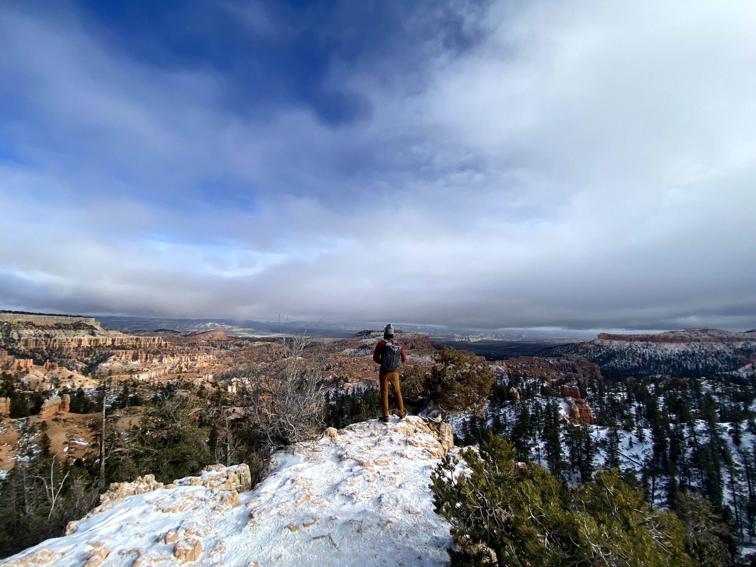
day 14 - bryce canyon national park, utah
View from Sunrise Point, Bryce Canyon, UT
Sunrise point at sunrise and then to the Queen’s Garden Loop trail up to Sunset Point and then took the Rim trail back to Sunrise. The conditions were perfectly clear and sunny, so we decided that we had to give Rainbow Point another go. We drove up and the view was spectacular, the conditions were totally clear and you could see the entirety of the canyon and the mountains in the distance. A lesser known trail at Rainbow point is Bristlecone Trail which is a lovely nature walk that was totally secluded-again, we were the only ones walking the trail on fresh snow laid out from the night before. The trail took us to the Yavampi Viewpoint overlooking a view on the other side of the canyon, and then the trail loop took us back to Rainbow Point. From there we said goodbye to Bryce Canyon and were on our way to Zion.
Rainbow Point, Bryce Canyon National Park
We arrived in Zion just as the sun was beginning to go down, which is early because in Zion you are in a deep valley. We went to Canyon overlook for the sunset, which was not visible, but the moonrise was really lovely. Later that night we stepped out and attempted to find a good spot for stargazing. We ended up at the Visitor Center which had perfect visibility of the skies and benches to lie down on and look up.
Miles: 9.77
Song of the Day: Beautiful Boy, John Lennon
day 15 - zion national park, utah
Treacherously high and icy, Angel’s Landing in the winter is not for the faint of heart!
The goal this morning, like all other mornings, was to be up bright and early to hit the trail head for Angel’s Landing, a heavily trafficked trail that leads to a ridge that is not for the faint of heart. If you’re not into heights, then you would certainly conquer your fears by climbing this ridge, using chains bolted into the ridge to pull yourself up, and mainly, to prevent you from plummeting off of the staggeringly high and narrow cliffs. We got a coffee and breakfast sandwich from Deep Creek Coffee which was exactly what we needed for a climb like this. The phrase ‘the early bird catches the worm’ never rings truer than it does when hiking. You have to drive in to get a parking spot at ‘the Grotto’ which is right at the trail head, and if that tiny lot fills up, you have to park a mile or even farther away and walk in the freezing cold dark just to get to the trail head. Luckily, we snagged the very last spot in the lot, scarfed down our sandwiches and coffee, and got going. The most dangerous part about Angel’s Landing is not the technical aspect of the ridge, but rather how heavily trafficked it is. There is a constant stream of people going both up and down, but if you go at first light, the amount of people is significantly less, and it is much more doable. I can’t even imagine what it would be like during high season. My experience was great, I thought it was a super fun climb, especially using the chains fixed into the rocks, it made me feel like I was climbing my own Everest. The view at the top after a thrilling climb was absolutely breathtaking. Heading down was a bit of an ordeal, but again, I can’t even imagine what it would be like in the Summer months.


Our next trail was headed towards The Narrows which is a seasonal hike because you wade through water sometimes waist deep through a narrow slot canyon to an enclosed area called The Subway. You can do this in the winter with gear that you can rent from park services, however they warn that you can become hyperthermic after 15 minutes of wading in the water, and it would take us more than 15 minutes just to get to the subway, let alone back. Instead we opted to remain dry and simply follow the trail along the river reaching the narrows, stopped to collect rocks and meditated by the riverside. After, we stopped for lunch at Oscar’s in Zion which was delicious but the portions were enormous, we needed a siesta after!


The Watchman’s Trail, Zion National Park
In the late afternoon, we set out toWatchman’s Trail an easy out and back trail with a lookout point facing West, which took about 1.5 hours to complete. While the sun was dipping below the mountains in the west, the Eastward mountains were illuminated, as though they could retain the sun’s golden light along with the warmth. The trail ended right by our lodge in Springdale, and we stopped at the Zion Brewery for some beers outside and watched the first stars appear in the sky.
Miles: 13.36
Song of the Day: Spanish Pipedream, John Prine
day 16 - back to kanab, utah
Red Canyon aka Peekaboo Slot Canyon, Kanab, UT
As mentioned, the Tesla Model 3 can only take us so far into some trails, there are other canyons we wanted to see that can only be accessed with permits and a guide, so we booked a tour with Dreamland Safari in Kanab to go check out Red Canyon (also known as Peekaboo) and White Wave Rock. Our tour was brilliant and we had a really excellent and knowledgeable guide who uncovered sea urchin fossils, petroglyphs, and pieces of ceramic in the ground. Red canyon is a slot canyon that is formed over time with wind and water erosion. We saw some Hopi Indian foot holds dating back 800 years which the Indians would use to climb up the wall of the slot to store grains atop the rock shelf. White Wave Rock gets its name from the wave like patterns caused by wind erosion over the earth’s surface, it’s pretty amazing to look at the texture and realize you could tell which direction the win was blowing from thousands of years back.


These two destinations take a bit of time to get to, as you have to do some pretty intense 4 wheel driving through sand dunes. In hindsight, we should have booked a full day tour with this company, as it took us another hour to get back to Zion, and there was a lot of transit time on the tour. We arrived in Zion with just enough time to do one more hike before the day was done. We opted for the Emerald Pools trail, an easy 3 mile loop with only 70 feet elevation gain.
Miles: 9.4
Song of the Day: Gotta Travel On, The Seekers
day 17 - kolob canyon, zion utah to las vegas
Kolob Canyon, Zion National Park, UT
Our last morning of the trip together, we stopped at FeelLove Coffee in Springdale, for some seriously good specialty coffee. I recommend their signature coffee drink called Self Love. They also have a good selection of CBD products, including some gummies by Goat’s. Feeling sufficiently caffeinated, we hit the road to get to Kolob Canyon, located on the North side of Zion National Park. These trails are much less trafficked than the greater ‘hits’ accessed through the South entrance. We did a short out and back to a nice viewpoint of the canyon. Making this our last stop in Utah, this put us en-route to Vegas with a charging session in between. In las Vegas, we tried to avoid the strip and surrounding scenery at all costs, it felt too chaotic in comparison to the peaceful nature we had been immersed in for nearly three weeks. We opted for a class at Modo Yoga Las Vegas instead to find some peace and get a good stretch in to the end of my leg of the trip. Modo Yoga has 85 locations worldwide, and as a Modo teacher and diehard student for this practice, I felt right at home at the Las Vegas location. Every time you go a Modo Yoga, no matter the city, you know exactly what you’re getting and it feels like home. The vibe, the architecture of the space, the accessible sequence, and down to earth teachings were exactly what we needed to come down from and to ground our sore mountain hiking feet.
Miles: 4.58
Song of the Day: This Land Must Die, The Country Gentlemen
From here, Grant and I parted ways, we plan to reunite on the West Coast soon to continue our travels along the Pacific Coast, and eventually up to our Canadian brothers and sisters in the North! Thanks for reading, I hope my journey motivates you to get out there and explore the wonders that our National Parks hold!